Photographs of Pine Ridge
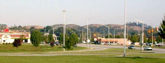
This photo shows how Pine Ridge dominates the skyline throughout the city center area. Until the mid-summer of 2001, the ridge supported a healthy, mature hardwood forest typical of this region of the Southern Appalachian Mountains. With the trees cut down and the topsoil stripped, it looks more like a scene from a desert region. Bulldozing and blasting, intended to flatten the ridge, are rapidly altering even this view, as shown in Councilman Len Abbatiello's September 30 aerial photos and in the photo below.
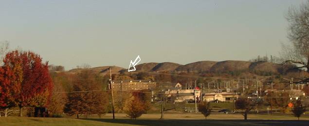 This photo taken in early November shows changes from continued grading and blasting. The arrow indicates the essentially flat surface of what remains of the first ridge. Some people have pointed out that the planned final contours will resemble a completed landfill or waste disposal cell.
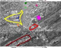
Click on this thumbnail image to see a larger-scale air photo of Pine Ridge, showing it in relation to the city center and other Oak Ridge landmarks.
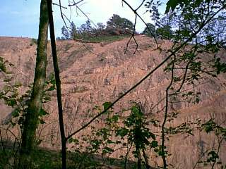
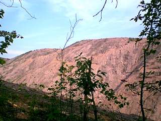
From Scarboro Road the destructive aftermath of the land-clearing activity is evident. Note the severe rill erosion visible in the photo on the left.
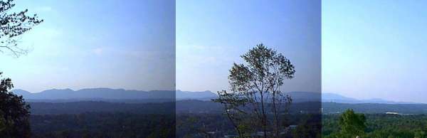
This composite image illustrates the type of vista that would be available if this 70-acre segment of Pine Ridge is saved from further destruction and converted to a public park. The city of Oak Ridge lies in the foreground and the Cumberland Mountains are silhouetted against the sky.
Return to main Pine Ridge page